


Voting District 10636, Los Angeles County, California
About
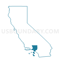
Outline

Summary
| Unique Area Identifier | 533623 |
| Name | Voting District 10636 |
| County | Los Angeles County |
| State | California |
| Area (square miles) | 1.77 |
| Land Area (square miles) | 1.73 |
| Water Area (square miles) | 0.03 |
| % of Land Area | 98.11 |
| % of Water Area | 1.89 |
| Latitude of the Internal Point | 33.90493930 |
| Longtitude of the Internal Point | -118.04141680 |
Maps


Graphs
Select a template below for downloading or customizing gragh for Voting District 10636, Los Angeles County, California


Neighbors
Neighoring Voting District (by Name) Neighboring Voting District on the Map
- Voting District 10279, Los Angeles County, CA
- Voting District 10282, Los Angeles County, CA
- Voting District 10639, Los Angeles County, CA
- Voting District 10645, Los Angeles County, CA
- Voting District 43954, Los Angeles County, CA
- Voting District 44272, Los Angeles County, CA
- Voting District 44275, Los Angeles County, CA
- Voting District 44281, Los Angeles County, CA
- Voting District 44317, Los Angeles County, CA
Top 10 Neighboring County Subdivision (by Population) Neighboring County Subdivision on the Map
Top 10 Neighboring Place (by Population) Neighboring Place on the Map
- Norwalk city, CA (105,549)
- South Whittier CDP, CA (57,156)
- La Mirada city, CA (48,527)
- Santa Fe Springs city, CA (16,223)
Top 10 Neighboring Elementary School District (by Population) Neighboring Elementary School District on the Map
- Little Lake City Elementary School District, CA (33,756)
- South Whittier Elementary School District, CA (28,813)
Top 10 Neighboring Secondary School District (by Population) Neighboring Secondary School District on the Map
Top 10 Neighboring Unified School District (by Population) Neighboring Unified School District on the Map
Top 10 Neighboring State Legislative District Lower Chamber (by Population) Neighboring State Legislative District Lower Chamber on the Map
Top 10 Neighboring State Legislative District Upper Chamber (by Population) Neighboring State Legislative District Upper Chamber on the Map
Top 10 Neighboring 111th Congressional District (by Population) Neighboring 111th Congressional District on the Map
Top 10 Neighboring Census Tract (by Population) Neighboring Census Tract on the Map
- Census Tract 5030, Los Angeles County, CA (6,057)
- Census Tract 5040.02, Los Angeles County, CA (5,383)
- Census Tract 5041.01, Los Angeles County, CA (5,126)
- Census Tract 5523.01, Los Angeles County, CA (4,900)
- Census Tract 5039.02, Los Angeles County, CA (4,636)
- Census Tract 5523.02, Los Angeles County, CA (3,648)
- Census Tract 5031.05, Los Angeles County, CA (3,634)
- Census Tract 5524, Los Angeles County, CA (2,794)
- Census Tract 5031.04, Los Angeles County, CA (2,719)
- Census Tract 5028.02, Los Angeles County, CA (1,380)